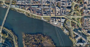
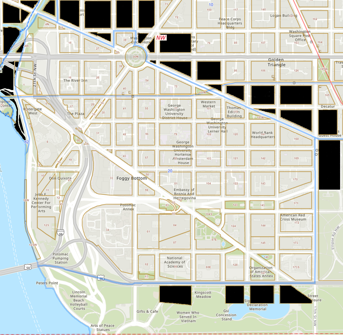
Foggy Bottom is a neighborhood in Washington, D.C., located in the city’s northwest quadrant. The Potomac River and Georgetown border it to the west, the West End and Golden Triangle to the north, the White House grounds to the east, and the National Mall to the south, as indicated by the blue boundary line in Figure 1 – The Extents of Foggy Bottom.
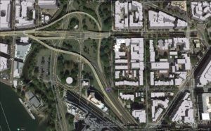
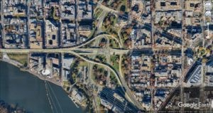
The Potomac River Freeway disrupted the urban grid, making Georgetown inaccessible. The Benito Juarez Circle was split into two separate crescents, restricting access to the Kennedy Center and making it difficult to reach the New Hampshire Avenue waterfront.
One of L’Enfant’s main streets, known as a “vista avenues,” provides pedestrians with a visual connection to the National Mall and a sight line to the Washington Monument. However, it can only be seen from a small median in the middle of Virginia Avenue NW.
The Federal Government’s opportunity:
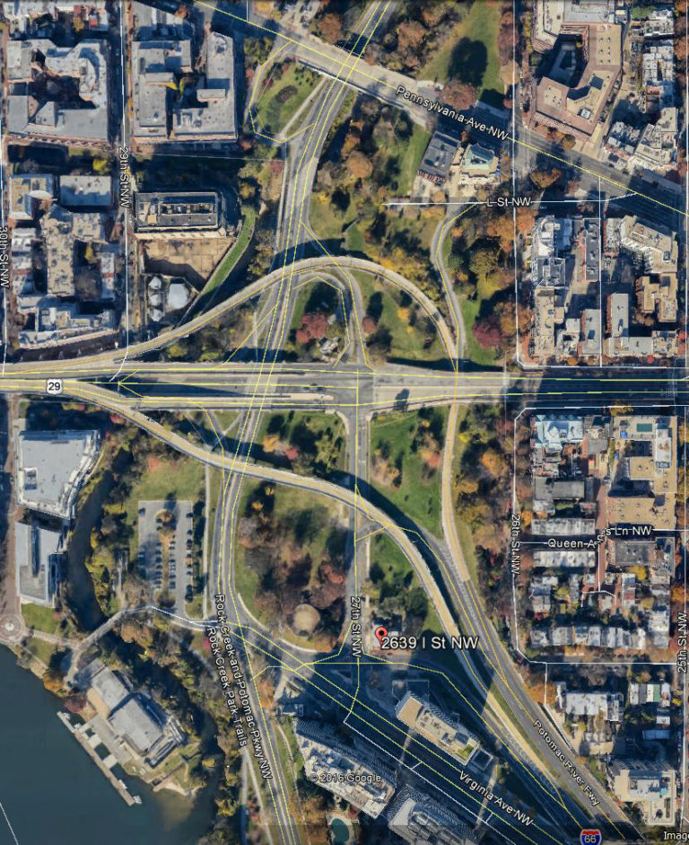
Most of the undeveloped, underdeveloped, or maldeveloped land in Foggy Bottom is owned by the federal government or acquired with funding from the Federal Highway Administration (FHWA).It is managed through an agreement with the District of Columbia Department of Transportation (DCDOT). The unfinished Potomac River Freeway Interchange with the Whitehurst Expressway, the Expressway itself, and the flyover ingress and egress ramps to the Theodore Roosevelt Bridge remain the area’s most prominent anachronistic auto-centric structures.
The FHWA has indicated that all undeveloped land in the area is open for alternative uses, and the Department of Transportation has expressed a willingness to consider alternative outcomes for the Interchange in capping the Potomac River Freeway and eliminating ramps. Typically, when land purchased with FHWA funds is considered surplus, the federal government waives repayment based on current value to help municipalities upgrade outdated highway infrastructure. Moreover, the federal government aims to promote housing, commercial development, recreational, and aesthetic purposes. In this case, it aims to expand the memorial core and create additional performance venues adjacent to the Kennedy Center.
Since this is federal land, both DCDOT and the DC government have been reluctant to take action unless the federal government takes the lead. If the federal government decides to proceed, redeveloping federally owned parcels can be fast-tracked. This can affect various aspects of a redevelopment project, including zoning, environmental, and other land use requirements. Ensuring that any development occurs as a public-private partnership with the federal government is likely the best alternative.
Federal funding is essential for the mall expansion, reconnecting the Kennedy Center, and modifying access to the Roosevelt Bridge. However, the NW section, known as the Foggy Bottom urban interface, lends itself to various private sector solutions that could contribute to this goal
The federal government’s direct financial involvement in necessary infrastructure redevelopment in the areas next to the Kennedy Center, the National Mall, and land accommodations/air rights concerning the Potomac River Freeway is essential. However, the Foggy Bottom Urban Interface section best serves as a model for Public-Private Partnership (PPP) development and reflects the current administration’s priorities.
Local Governance Component:
The Foggy Bottom area should have its own Business Improvement District, that includes all property.
This will help pay for enhanced law enforcement, street maintenance, and other services as appropriate.
It would also fill a gap between the Georgetown, Golden Triangle, and Downtown BIDS.
Photographs, Maps, and Memorabilia (under construction)
- 1948 National Geographic Map of Foggy Bottom Historic Base Map of 27th and I Street, NW
- Historic Square 5 Alley and Walkway Easements
- 1965 Baist Map of Foggy Bottom
- Foggy Bottom & Whitehurst Freeway Overview
- Historical photographs of Foggy Bottom
- Street level photographs
- Watergate East The First 25 Years
Current Planning Reports & Proposals (under construction)
- REARCHITECTING THE POTOMAC RIVER FREEWAY INTERCHANGE ENABLES RESPONSIBLE DEVELOPMENT:
- Overview Infographic, September 28, 2024
- Narrative Submission for Federal Department of Transportation Consideration, Foggy Bottom Future Inc, September 28, 2024
- REPAIRING & CONNECTING: Kennedy Center, Lincoln Memorial, The Potomac River, Rock Creek Park, and The National Mall, National Capital Planning Commission (NCPC), Final Report, September 11, 2023
- KENNEDY CENTER CULTURAL DISTRICT LAND USE ACTION PLAN: Opportunities for Investing in the Future of Foggy Bottom, Technical Assistance Panel (TAP) Report, The District of Columbia Office of Planning (DCOP), and the National Capital Planning Commission (NCPC), September 27-28, 2023
- HOTD Microgrid Market Potential Analysis: Expanding Steam and Electrical Loads, Urban Ingenuity, Shalom Flank, Ph.D., Microgrid Architect, Bracken Hendricks, CEO, December 2016
- Feasibility Assessment for a Main Street Program for Foggy Bottom and West End
Ground Truth (under construction)
- Parcel Overview
- Parcel – 1 Square 5, Barnhard Family LLC Property
- Parcel – 2 Square 5, City/Private Property
- Parcel – 3 Square 5, Department of Transportation (DOT) Property
- Parcel – 4 Square 6, Gas Station Property
- Parcel – 5 Square 5/6, I Street Road Right of Way
- Parcel – 6 Square 6, Boat House Apartments
- Parcel – 7 Square 6, DOT Property
Development Proposals 1992 – 2004 (under construction)
- Watergate North Proposal — March 1998
- Watergate North Zoning Analysis_4-16-1999_1
- Watergate North Plan View
- DC Department of Public Works Letters to Dale Barnhard 6-25-1998
- Prospective Development of 2690 Eye St — February 2002
District Comprehensive Plan (under construction)
- Current Comprehensive Plan
- DC COMPREHENSIVE PLAN PUBLIC TESTIMONY, Gary Pearce Barnhard, November 12, 2020 (v1.2 as presented)
- District Elements_Volume II_Chapter 21_April 8 2011
- Proposed Amendments 2017
- 2.5 Foggy Bottom West End Proposed Introduction Amendments
- 2.5 Foggy Bottom West End Proposed Policy Amendment
Community-Related Presentations and Reports (under construction)
- National Capital Planning Commission Kennedy Center Accessibility Study
- EEK Reclaim the City Fabric Presentation
- EEK Citywide Highway Repair Study
- Whitehurst Freeway Existing Conditions Report
DC Office of Zoning (under construction)
- DCOZ_report_201544-Square-1
- DCOZ_report_201544-Satellite
- DCOZ_report_201544-Satellite-try-2
- DC-Base-Map-27th-and-I-Street
Aerial Photographs (under construction)
